How to Create & Publish WCS (Web Coverage Services) in GeoServer.
తెలుగులో నేర్చుకుందాం
What is WCS?
A WCS provides access to coverage data in forms that are useful for client-side rendering, as input into scientific models, and for other clients. The WCS may be compared to the OGC Web Feature Service (WFS) and the Web Map Service (WMS). As with WMS and WFS service instances, a WCS allows clients to choose portions of a server's information holdings based on spatial constraints and other query criteria.
Publishing WCS
Web Coverage Service (WCS) provides an open specification for sharing raster datasets on the Web. The raster datasets made available through WCS services are coverages.
A WCS service returns data in a format that can be used as input for analysis and modeling. This is in contrast with OGC WMS services, which only return a picture of the data.
Generally, there is no need to do anything specific to get use a WCS Service when you publish a Raster Layer in Geoserver. One can think of it as Web Feature Service (WFS) for raster data.The WCS Service is already running.
Benefits of WCS
WCS provides a standard interface for how to request the raster source of a geospatial image. While a WMS can return an image, it is generally only useful as an image. The results of a WCS can be used for complex modeling and analysis, as it often contains more information. It also allows more complex querying - clients can extract just the portion of the coverage that they need.
In this exercise we will discuss on the WCS 2.0 protocol version, as it’s easier to explain compared to the older 1.0 and 1.1 versions.
Click on the GeoServer logo at the top left corner as shown in the figure 79
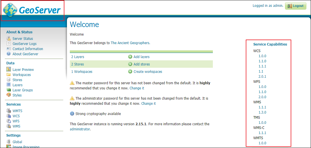
Figure 79 - Geoserver Welcome page
On the right side of the page, WCS, WFS, WMS, TMS, WMS-C & WMTS services capabilities will be displayed
Figure 80 - Copy link address

Figure 81 - WCS link pasted in notepad
Add Image WCS to QGIS
In the browser panel, locate the WMS/WMTS and right click it to add a new connection.
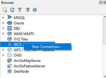
Figure 82 - Browser Panel in QGIS with WCS
Name your connection. This is not the name of the layer but the name of service which is offering the WCS layer.

Double click on the layer from WCS to add to layer panel.

Figure 85 - Displaying Image from Geoserver to QGIS through WCS
Tip: You can directly export to geotiff/tiff/jpeg (image format) from WCS, where as you cannotdo the same with WMS.
Comments
Post a Comment